For my birthday weekend (October 30 - November 1, 2010), Daniel and I stayed in Lewisburg, WV and rode our bikes down a 53-mile section of the Greenbrier River Trail. I had discovered the trail while staying in Cass, WV the previous year and had been wanting to take my bike there ever since. The great time I'd had while biking other rail trails (such as the James River Heritage Trail) had continued to fuel the desire. A birthday is as good an excuse as any for a long weekend trip!
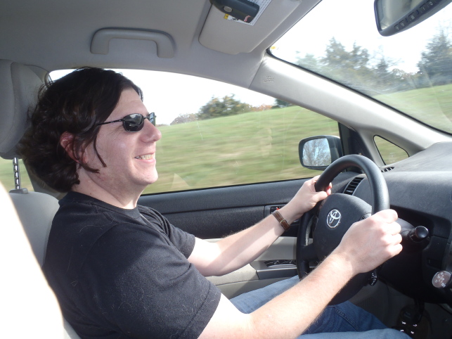 For my birthday, Dan gave me a waterproof digital camera that I can take on canoe trips and out hiking in the rain. I assembled it (battery, memory card, wrist strap) in the car as we headed for West Virginia. This was the first picture I took. Many a happy day starts this way, heading out in Dan's Prius (more efficient than my Civic!) for somewhere away over the countryside.
 In Covington, Virginia, we got off the highway to look for a geocache that sounded interesting. It was placed at the site of this old covered bridge, called the Humpback Bridge.
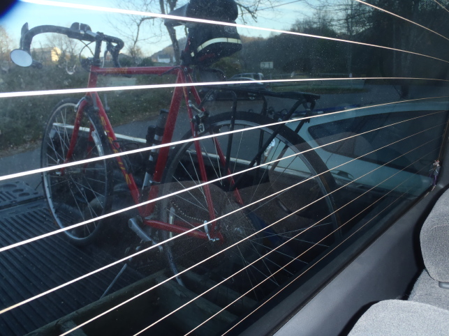 We got up early on Halloween morning, had a delicious breakfast at the General Lewis Inn (mmmm . . . fresh biscuits with apple butter), then went to the Caldwell (near Lewisburg) trailhead of the Greenbrier River Trail. There we met Tracy of WV Outdoor Adventures. He propped our bikes up in the bed of his pickup truck (unfortunately I didn't get a good photo of the purpose-made wooden rack, which I admired; you can see one corner of it propping up my rear tire here) and drove us north to Marlinton, where he dropped us off near milepost 56 of the old Greenbrier River railroad. (The Caldwell trailhead is at milepost 3.) I think it was on the hourlong drive north that Daniel and I started saying to ourselves "We're going to cover this much distance on bikes? Really? Are we ready for this?!"
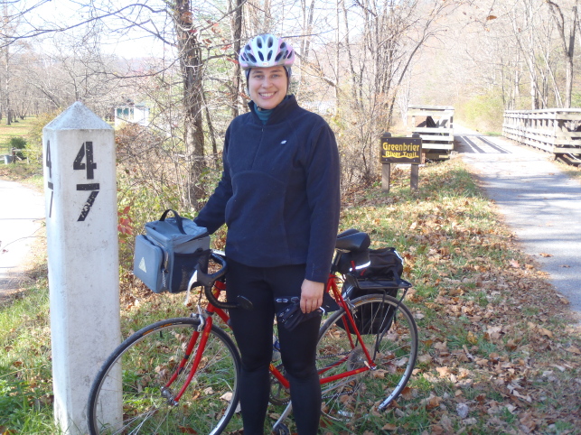 At Marlinton, we found a (very nice) public restroom at the tourism office, then headed down the trail at a strong but not too tiring pace. I wanted to get some miles behind us and it didn't occur to me to stop for pictures until we got to milepost 47.
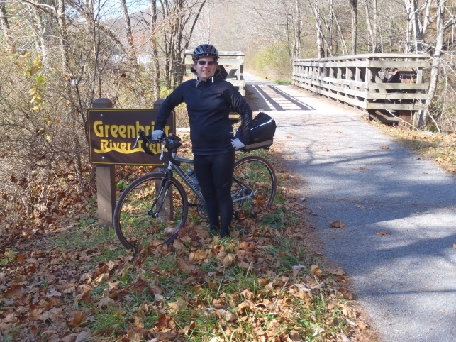
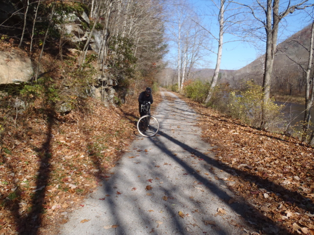 This is what most of the trail looked like. A few miles near Marlinton were paved, but most of the trail was hard-packed dirt with a thin covering of fine crushed stone. The trail rarely wandered out of sight of the river.
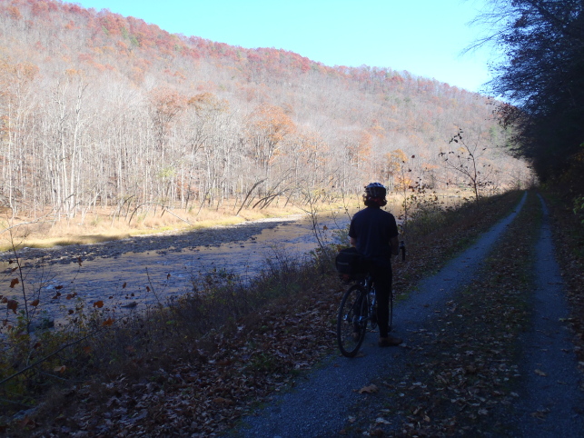
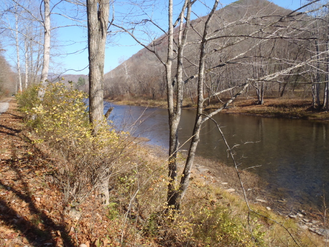 The Greenbrier River wends back and forth between the mountains, so as we rode the trail we kept coming around bends and seeing pretty vistas. We had missed the foliage season by a couple of weeks; I'm sure the scenery is even prettier with the leaves on.
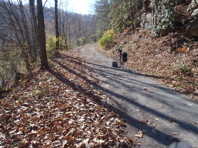
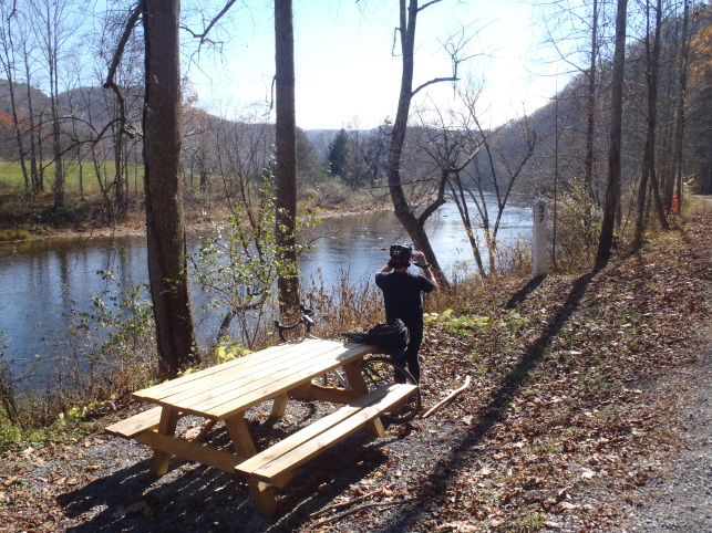 A little less than halfway through the ride we stopped at this nicely-situated picnic table for a heavy snack of dried fruit, nuts, apples, and electrolyte drinks.
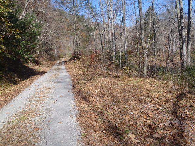 Then we headed on down the trail again.
 Near the Droop Mountain Tunnel, we met this couple on their horses. They live nearby and ride the trail frequently.
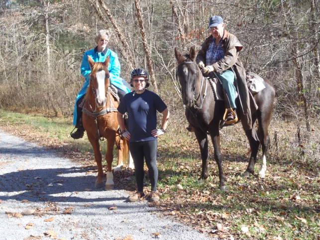 They were more than happy to have pictures taken with the horses.
 Here I am at the entrance to the Droop Mountain Tunnel. As you can see by the bit of sky in the upper left corner of the photo, the ridge that the tunnel passes under is not all that high, but it makes a long, bulbous bend in the river which would have been impossible to run train tracks around. I'm not sure why they built a tunnel rather than blast a canyon open—I suppose it has to do with the type of rock, its depth, and the engineering standards of the time.
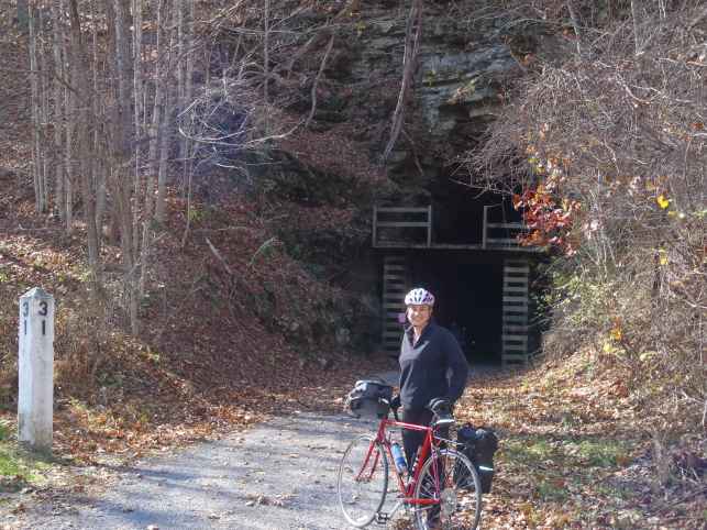 The tunnel was long (402 feet / 122 meters), curved, and unlit. Daniel and I rode briefly in total darkness before coming around the bend enough to see, literally, the light at the end of the tunnel. It was a bit unnerving. I turned on my little four-LED bike light on my handlebar, but the darkness in the tunnel was so deep that I saw only the barest shimmer reflecting back off the rafters; I couldn't make out the ground in front of me, and rode forward in blind trust that there would be no hazards on the floor of the tunnel.
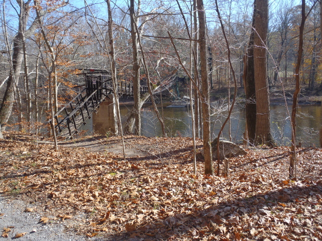 We passed a few private islands connected to the river bank by rickety bridges of various sorts. This one was one of the most sophisticated, built on concrete pilings and protected by a locked gate.
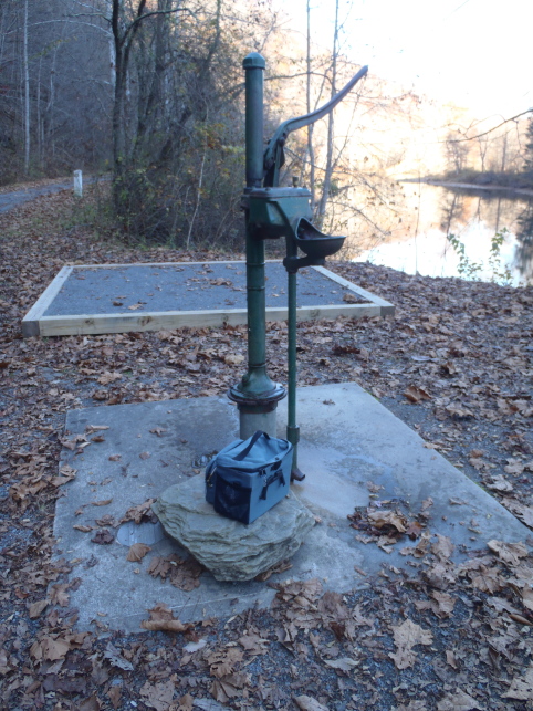 One of the rather charming hand-operated water pumps that we found along the way. It has a special spigot for filling your water bottle (not shown) in addition to the drinking fountain that arcs into the basin on the front. Behind the pump you can see a tent platform; the trail is also improved with outhouses and designated equestrian campsites.
As I mentioned, most of the trail was hard-packed and covered with just a little crushed stone; it was easy going, even on our narrow road tires. (Wide tires are generally recommended for this trail, but based on what I had seen at the Cass end of it, I had guessed that we could get away with using road bikes.) In the last 15 miles or so of our ride, however, we encountered several long stretches of trail that had recently been resurfaced with a thick layer of fine-crushed stone. It was like trying to ride your bike through an inch or two of kitty litter. It was very tough going. I almost fell over once or twice, but instability was less of a problem than rolling resistance. It just took a lot of work to push our bikes through the soft surface. If I had known about the trail conditions in advance, I would have arranged for us to get off the trail earlier. I think if we had not encountered the soft surface, we would have ended the day tired and well-exercised but in good spirits and not utterly exhausted. Once we got into the "kitty litter," though, we rapidly depleted our energy reserves and it was hard to stay in a good enough mood for picture-taking. (As our speed dropped significantly, it also became more urgent to press on and make sure we could get back to the car before dark.) The camera finally came out again once we had made it back to the Caldwell trailhead.
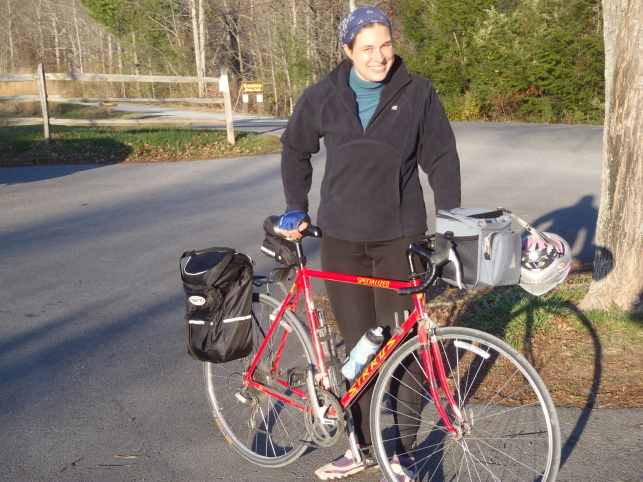 At the end of the trail, I was pleased that we had done the ride and very happy to know that there was a hot shower, a hot dinner, and a warm bed in my near future!
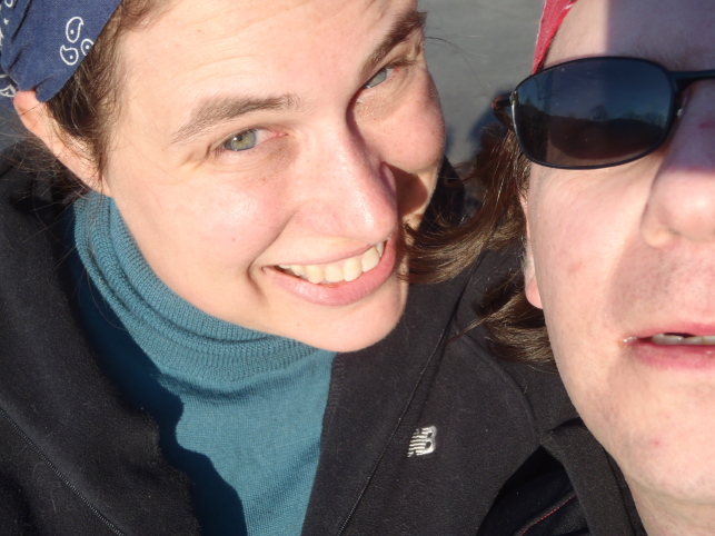
 For my birthday, Dan gave me a waterproof digital camera that I can take on canoe trips and out hiking in the rain. I assembled it (battery, memory card, wrist strap) in the car as we headed for West Virginia. This was the first picture I took. Many a happy day starts this way, heading out in Dan's Prius (more efficient than my Civic!) for somewhere away over the countryside.
 In Covington, Virginia, we got off the highway to look for a geocache that sounded interesting. It was placed at the site of this old covered bridge, called the Humpback Bridge.
 We got up early on Halloween morning, had a delicious breakfast at the
  At Marlinton, we found a (very nice) public restroom at the tourism office, then headed down the trail at a strong but not too tiring pace. I wanted to get some miles behind us and it didn't occur to me to stop for pictures until we got to milepost 47.
 This is what most of the trail looked like. A few miles near Marlinton were paved, but most of the trail was hard-packed dirt with a thin covering of fine crushed stone. The trail rarely wandered out of sight of the river.
 The Greenbrier River wends back and forth between the mountains, so as we rode the trail we kept coming around bends and seeing pretty vistas. We had missed the foliage season by a couple of weeks; I'm sure the scenery is even prettier with the leaves on.
 A little less than halfway through the ride we stopped at this nicely-situated picnic table for a heavy snack of dried fruit, nuts, apples, and electrolyte drinks.
 Then we headed on down the trail again.
 Near the Droop Mountain Tunnel, we met this couple on their horses. They live nearby and ride the trail frequently.
 They were more than happy to have pictures taken with the horses.
 Here I am at the entrance to the Droop Mountain Tunnel. As you can see by the bit of sky in the upper left corner of the photo, the ridge that the tunnel passes under is not all that high, but it makes a
  The tunnel was long (402 feet / 122 meters), curved, and unlit. Daniel and I rode briefly in total darkness before coming around the bend enough to see, literally, the light at the end of the tunnel. It was a bit unnerving. I turned on my little four-LED bike light on my handlebar, but the darkness in the tunnel was so deep that I saw only the barest shimmer reflecting back off the rafters; I couldn't make out the ground in front of me, and rode forward in blind trust that there would be no hazards on the floor of the tunnel.
 We passed a few private islands connected to the river bank by rickety bridges of various sorts. This one was one of the most sophisticated, built on concrete pilings and protected by a locked gate.
 One of the rather charming hand-operated water pumps that we found along the way. It has a special spigot for filling your water bottle (not shown) in addition to the drinking fountain that arcs into the basin on the front. Behind the pump you can see a tent platform; the trail is also improved with outhouses and designated equestrian campsites.
 At the end of the trail, I was pleased that we had done the ride and very happy to know that there was a hot shower, a hot dinner, and a warm bed in my near future!
