What I would like to do here is just hit on some of the highlights from my pictures of our geocaching runs. I'd like to share the most interesting destinations (see below for several recommendations for good places to take a walk or spend the day hiking), sights, and caches we have come across.
WARNING: The following pictures and descriptions include some geocaching "spoilers," which seem OK to publish in this context because this page is meant mainly for sharing with friends and family who are not interested in geocaching or do not live in the geographic areas described. If you came across this page by accident and are interested in geocaching in central Virginia or southeastern Massachusetts, consider yourself warned.
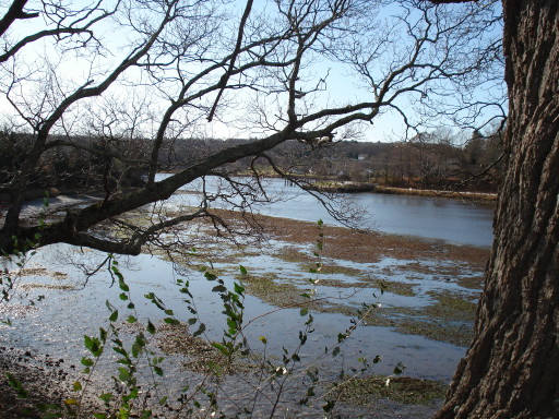
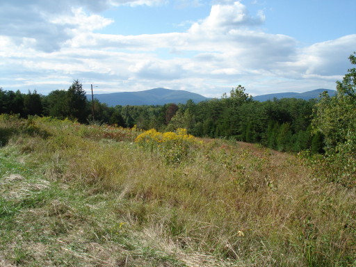
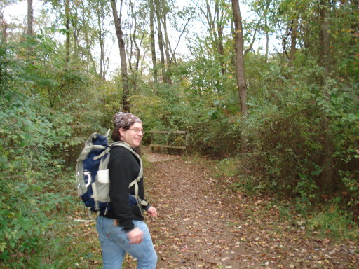
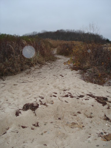
On this day, we headed north towards Harrisonburg. On the way there, we stopped to seek several caches spread around in a Greene County Park. The park looked like it had been constructed just recently, and it featured a trail system which took us through the woods to a hilltop meadow with Blue Ridge views. I thought the meadow was rather attractive, even though it bordered on a junk yard.
In the middle of the meadow, we saw this impressive tree, which I liked a lot.

We had to go off the trails to find most of the geocaches, including one that was intentionally situated to bring cachers to this little pond nestled in the woods.

While walking through the meadow, Daniel and I each picked up scores of these small, flat seed pods, which clung to our pants legs by means, I suppose, of tiny velcro-like hooks.
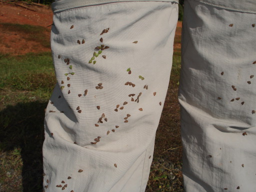

We picked them off one by one as we drove to Harrisonburg and released them out the car window, thus accomplishing the plant's objective of spreading its seeds far and wide.

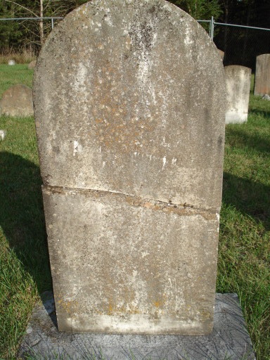
In Harrisonburg, we looked for a cache called "The Purloined Letter." Its description online had intrigued me. It said, "The search for this cache will take you to a destination within the City of Harrisonburg that very few know exist... Even among the locals, it is unknown to most. Yet it has been visited by thousands of people since the 1850's!" There were details about parking and the trail to the location, but the nature of the location itself was kept secret. We parked where directed and found a trailhead that was posted "No Trespassing," but with another sign underneath saying "Cemetery Visitors Welcome." We followed the trail and to our astonishment found this carefully-tended old cemetery surrounded by thick woods:

We did not see any signs indicating who maintained the cemetery. We wondered about that out loud.
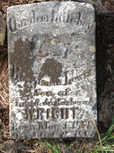
The cache itself lived up to its name. We followed the GPS pointer to an area in the woods outside the cemetery fence and hunted for a typical woodland geocache. After finding nothing, we consulted the coded clue in the cache's description, which said "No need to bushwhack. Stay on the established trail through the cedars." So we tried to discern a trail in the woods, again without success. Finally I turned back and walked back into the narrow clearing around the cemetery, where I spotted the cache:
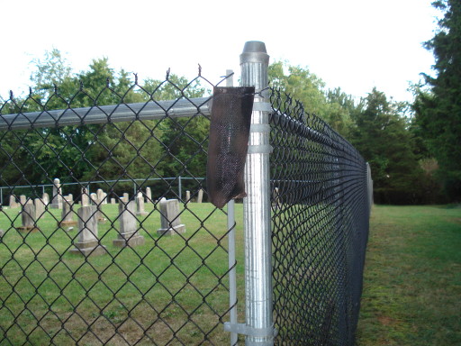
The cache is a plastic tube inside the black mesh sack hanging from the fence post--hiding in plain sight. We had walked right past it while focusing on getting into the woods. It didn't occur to us, after reading the clue, that the "trail" might refer to the mowed border outside the fence. The way this hide played on geocachers' habits, combined with the literary name and the surprising, interesting location made it one of my favorites so far.
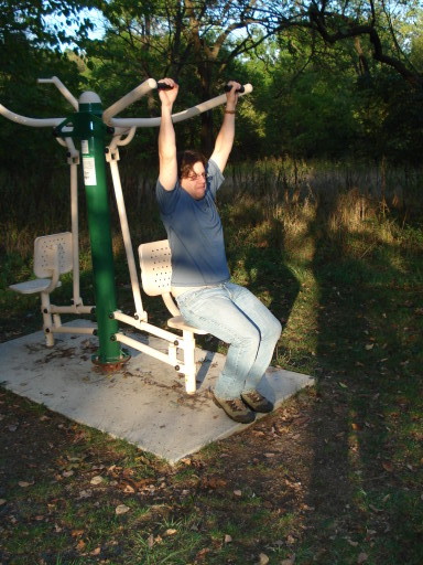
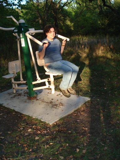
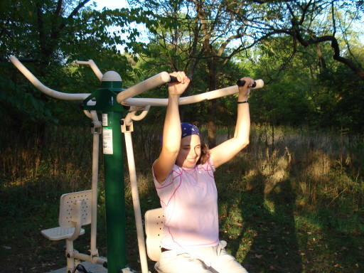
While in Harrisonburg, we also picked up some caches in Hillandale Park. This urban park did not have extensive wilderness trails, but it did have a fitness trail with several human-powered exercise and strength-training machines. I was especially intrigued by these non-electric elliptical trainers:
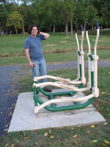
We couldn't resist trying out several of the other machines, too.
In the realm of caches, this park held some interesting finds as well. The cache below was called "gnome shelf." I admired its construction.

A dry fungus that didn't really belong on that particular tree concealed . . .
. . . a bracket supporting a camouflaged hide-a-key container.
The same people who created the "Gnome Shelf" cache also created one called "Rocket." In a little clump of trees between a field and a parking lot, we found this hollowed-out branch on the ground, with a film cannister tucked into the end.
We found the last cache of the day deep in a patch of woods where a dense network of mountain bike paths had been carved out. (I think more paths must have been added since that map was drawn. I remember a trailhead kiosk map looking more like a giant spiderweb.) At this cache I found a little purple frog, which I swapped for the red and green tree frog I had picked up on Erik's birthday.

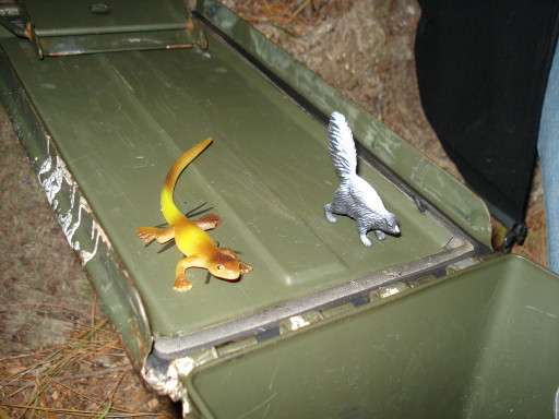
I bought a set of toy forest creatures to use as "trade items" when geocaching. The general rule is that if you take something out of a cache, you should leave something behind. Sometimes when we find poorly-stocked caches, I like to leave a toy or two in them without taking anything. But these little forest critters have caused me a problem.

They are too cute.

I have difficulty giving them up.

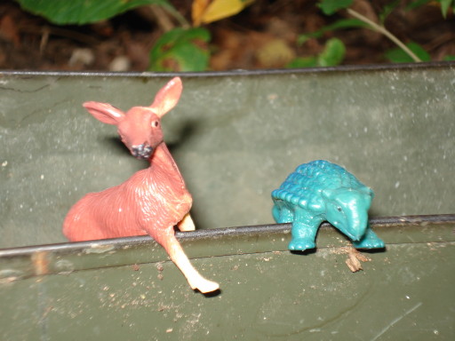
(The ankylosaurus was not part of the forest critters collection; it was in the cache where I left the deer.)
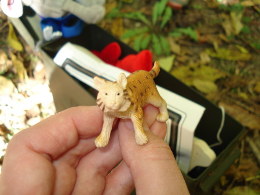


I have left most of them in caches by now, but I still have a few. In the meantime, I bought a second set of these molded plastic toys, but this time I chose a set of horses instead of the forest creatures. For some reason, the horses don't tug on my heartstrings in the same way.
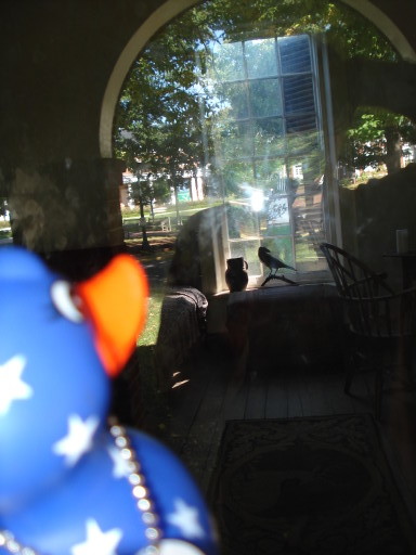
In the Greene County park that we cached in on September 27, I picked up this "Mystic Duck Travel Bug" from one of the caches.

A "travel bug" is an object that travels from cache to cache. Some have specific missions (e.g. to travel to a certain place); others just travel around wherever cachers take them. A metal dog tag attached to each travel bug carries a six-digit alphanumeric code which can be used to track the object online.
The Mystic Duck's description online asks geocachers to "Take pictures of him in cool places along the way, he's a BIG fan of magical sites!" So I took the duck to Edgar Allen Poe's student room at U.Va. and photographed him with the stuffed raven visible in the background. I don't know if that's a "magical site," but it was the closest thing I could think of!
Daniel and I have various methods for choosing where to go geocaching and which caches to look for. Sometimes we just look at the map of the area around Charlottesville on the Geocaching.com website and look for clusters of several geocaches in a small area. That's how we discovered the James River State Park.
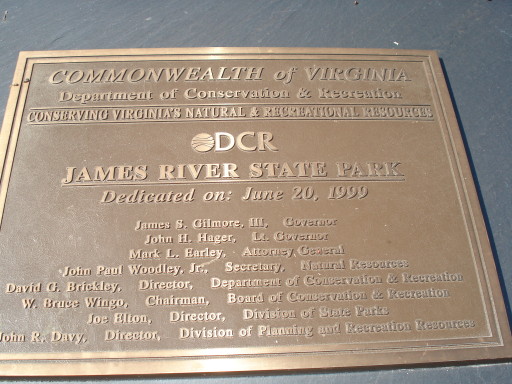
It's one of the newest state parks in Virginia, but it's been open as long as I've been living in Charlottesville, and I was astonished to discover such a nice park, so nearby, that I hadn't even heard of before geocaching brought it to our attention.
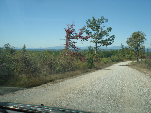
The road into the park passes through some private land that was obviously being used to raise and harvest trees--whether for timber, paper, or some other purpose, I couldn't guess. We drove through some areas that must have been clear cut within the past few months; some underbrush had started growing up, but the stumps looked fresh.
Once inside the park, we discovered well-planned facilities, all in nearly-brand-new condition. There were picnic shelters, restrooms, rental cabins, a boat launch, and areas for camping with or without horses. We parked at one of the picnic areas.

There are eleven geocaches hidden in the park; in an autumn day of hiking around on the park's trail system, we found only six of them. I hope we'll go back for the others some time.
One thing I found interesting was the fact that the park was making use of geocaches to attract visitors and educate them about historic sites within the park. Some of the caches we found were placed by other geocachers as usual, but some of the caches were clearly created by (or in close collaboration with) park staff, and contained notes explaining the significance of their locations. The park also provided a special guide for geocachers, which we found out about too late to pick one up at the entry station.
Here are some more pictures from the park. It's a nice place for a day out.


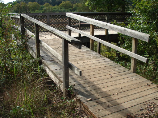
(The observation deck pictured above gave the view pictured below.)

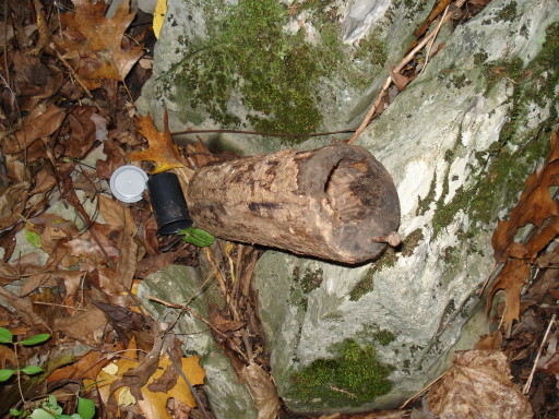
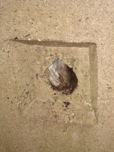
I thought the geocache below was an interesting hide. We went looking for a cache in a wooded area behind a picnic shelter. We hunted and hunted, but couldn't find it. Then we checked the clue for the cache, which said "What is out of place?" I glanced around and almost immediately spotted this log propped up in a ring of stones. It's funny how it blended into the environment until we were prompted to look for something out of place, and then it stuck out like a sore thumb.
As you can see in the picture, the top end of the log was sawn off and re-attached with a swivel hinge, while space was hollowed out of the log for a geocache container to be hidden. Unfortunately, the container was not watertight and the cache contents had gotten soaked, rendering the log (in the sense of "piece of paper to record one's visit") unusable.
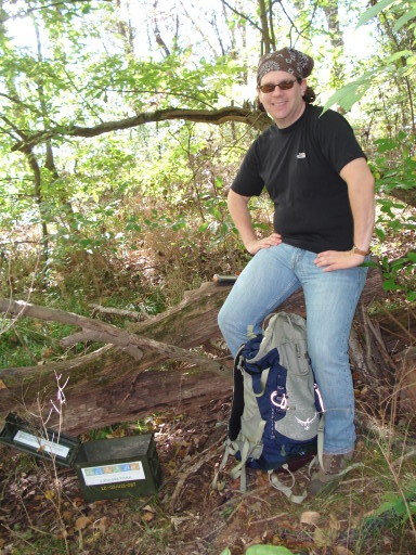
Here I am at the end of a great day of hiking and caching:
Very happy!
To choose the destination for our next day of caching, I put the directions N, NE, E, SE, and so forth into an online randomizer. It suggested that we travel northwest. When I checked a map, I found that the town of Grottoes in the Shenandoah Valley lay to the northwest of Charlottesville, so we researched a Grottoes-area pizzeria (it's good to know where your dinner is going to come from at the end of a long day of caching in unfamiliar territory) and headed out.
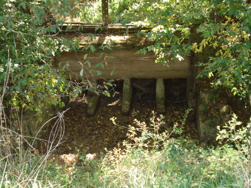
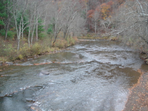
Early in the day, we looked unsuccessfully for a cache that was supposed to be hidden near a river. There was a dry parallel channel where I saw this old sluice gate, which I thought was interesting. Pete R., who leads canoe trips on local rivers for OASC, would probably know the history of this site and what kind of mill, factory, or dam was here. I might ask him about it some time.
We spent a chunk of the day looking for caches in Grand Caverns Regional Park. We didn't go into the caverns, but we checked out this neat old building where tickets and souvenirs were sold.

One of the caches was hidden up underneath the back side of this free-standing stage in one of the park fields.

After seeing a lot of very similar-to-each-other woodland hides (in hollows in trees, stumps, or dead logs, or under piles of sticks or rocks) I thought this find was kind of a nice change.
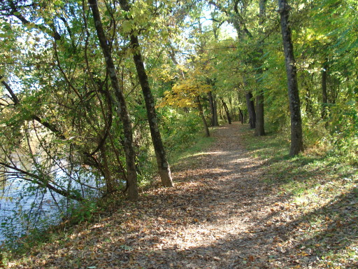
The park was not as extensive as some we have visited, but we did see this nice trail by the river.
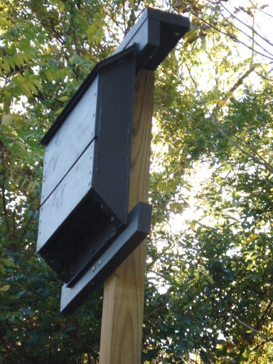
And I couldn't resist photographing this bat house near a baseball diamond. Go bats!
After leaving the Grand Caverns park, we looked for--and found--another riverside cache, at a local fishing hole. At this cache I swapped one purple frog for another. I also found a little sheep figurine in the cache and liked it, so I left a rabbit toy in trade for the sheep, thinking of Erik and Eppu in the frog + rabbit pairing.


Later in the afternoon, we looked for our first "multi-cache" in the village of Port Republic. A multi-cache involves two or more stages of hunting. In the case of the Port Republic multi-cache, we had to travel around the village gathering clues from historic signs in order to fill in the numbers in successive sets of coordinates; the series eventually led to a box in a hollow stump in a tiny local park.
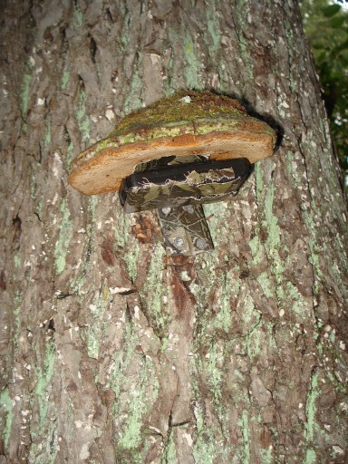
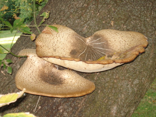
Along the way, we saw these dinner plate sized fungi growing on a tree trunk.
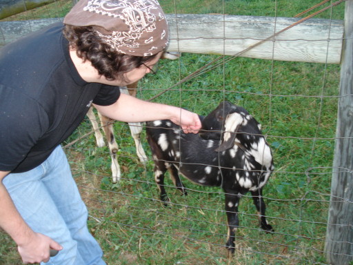
Then we spied a pair of goats in a farm field . . .

. . . and more goats in someone's back yard in the village!


A neighbor said they were named Sonny and Bono.

We looked for (almost!) the last few caches of the day in a new park on the edge of the town of Grottoes. This particular park was flat and open, featuring ball fields rather than woodland trails. It wasn't especially remarkable, and I'm in no hurry to return, but I was impressed by this custom park bench.

As we were leaving the park near nightfall, we decided to go for one more cache in the neighborhood. It turned out to be our favorite cache of the day, and one of my favorites of all the caches we have found. The description and the coordinates pointed us to a row of trees that stood between the end of a dead-end road and an empty lot. We walked along the row with our eyes cast down, looking for the sort of low nook or hollow among the roots in which geocaches are typically found. Then I noticed a small metal cleat on the back side (away from the road) of one tree. Wound around the cleat was a rope, and the rope ran up the tree to . . .

. . . the cache! It was suspended below a pulley. Dan very graciously gave me the honor of both lowering and raising the cache.
I traded a skunk from my woodland critters collection for a little lizard--possibly a skunk-for-skink trade?
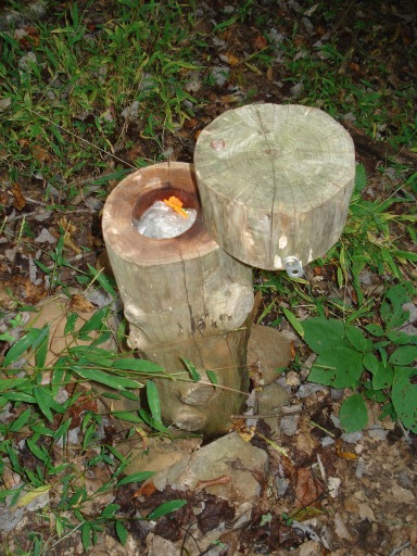
On this day, we headed north-northeast from Charlottesville to cache in the Orange and Culpeper areas. Our first find of the day was one of the best. The description said the cache was located outside a local business and was in an "appropriate container." The coordinates led us to an automotive service shop just outside downtown Orange. We poked around the bushes and a picnic table outside the shop, which was closed. We were starting to scratch our heads when Daniel recognized the cache:
It was disguised as a discarded Purolator oil filter, which had been left lying on the ground in an area that was otherwise neatly kept. A plastic tube had been carefully glued into the can, and the log for the cache was tucked into a smaller tube that slid into the first one.

We proceeded to pick up caches in a pretty little pocket park in downtown Orange . . .

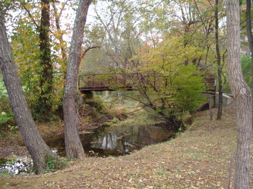
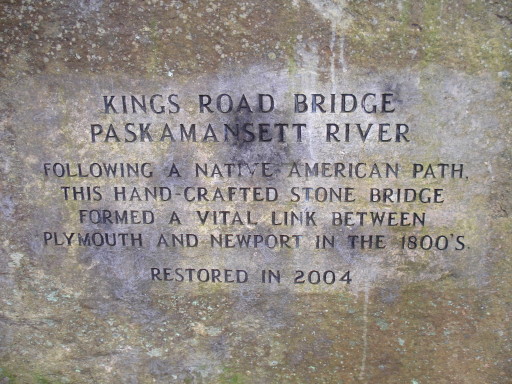
. . . and at an old, semi-abandoned bridge out in the country.
Before going out caching this weekend, we had somehow gotten to talking about corn mazes. We both were fascinated by the idea and wanted to do a corn maze, so we researched corn mazes in the area and found one near Culpeper. (It was one of our reasons for heading that direction for the day's caching.) We went to the farm, paid our entry fee, and hopped on a hay ride, excited to do the corn maze.


Look! CORN MAZE!!!
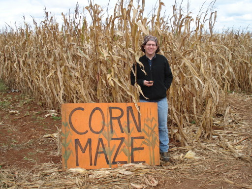
As it turned out, the corn maze gave us a nice view of the farm at one point . . .

. . . but it was disappointing overall. It was just too easy. There weren't a lot of choices of direction, and the dead ends became apparent very fast. There may not have been enough acreage to make a good corn maze, or the farmers might not have designed this one very well, or we may have simply had mistaken expectations. (We did notice after we got there that the other attractions on the farm--petting zoo, pumpkin patch, playground--were aimed squarely at the five-to-eight-year-old demographic.) For whatever reason, Dan and I made it through the farm's two advertised corn mazes in just a few minutes. The sense of adventure and intrigue we had started with quickly fizzled.
Oh well. At least we scratched the itch to visit a corn maze. Maybe someday we'll get to run a huge, well-designed, high-difficulty maze somewhere in the midwest.
For consolation, we cooed at the animals in the farm's petting zoo.


Our later adventures that day took us to various locations in and around Culpeper. The one that surprised me the most was Culpeper National Cemetery.

For some reason, I never knew that there were national cemeteries other than the one in Arlington, but as Daniel pointed out, "Not everyone can get into Arlington." (In case anyone is worried about a geocache violating the sanctity of a national cemetery: the cache we were seeking was actually hidden across the road, in a perfectly quotidian guardrail. Daniel and I nevertheless took the time to explore the cemetery and appreciate its residents' military service.)
 |
 |
 |
 |
After the interesting start with the Orange Purolator filter, we found most of the actual caches around the Culpeper area to be kind of uninspiring. One that was a little novel was hidden in (on? under?) this old caboose that was parked at the train station.
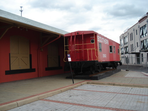
It took us a long time to find, even with the help of a fairly specific clue. The trick was that the cache was hidden in not-so-plain sight. It shows up clearly in the flash-lit photograph below:
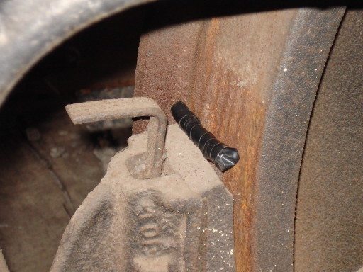
. . . but in the deep shadow of the caboose's undercarriage, that black tape-wrapped tube virtually disappeared from sight.

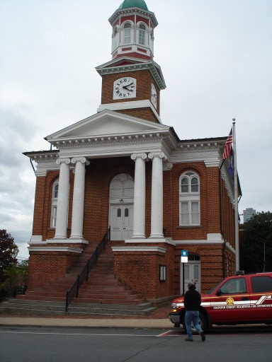
The town of Culpeper was sleepy compared to Charlottesville, but had a quaint feel; I enjoyed discovering its well-preserved downtown after years of knowing "Culpeper" only from the signs on the highway.

Our search for geocaches--which is becoming effectively a quest to discover all the state and municipal parks within an hour's drive of Charlottesville--brought us to Culpeper's Yowell Meadow Park. The trails there were attractive though not extensive.
One of the best parts of our day in Culpeper was dinner at the Hazel River Inn Restaurant, which was a little bit of a splurge but oh so worth it. DELICIOUS. Highly recommended.
For the weekend of my birthday, I requested a trip to Bath County so that I could soak in the warm springs that have been enjoyed by visitors since the eighteenth century. We had a really nice time on the trip; I quite enjoyed the soak as well as a delicious dinner at Fort Lewis Lodge, where the atmosphere reminded me a little bit of the dining pavilion at Maho, though with slightly more gourmet food and a rather different view.
Naturally we did some geocaching along the way, and as always, the hunt for geocaches brought us to places that we would not have otherwise known about, much less stopped to explore.
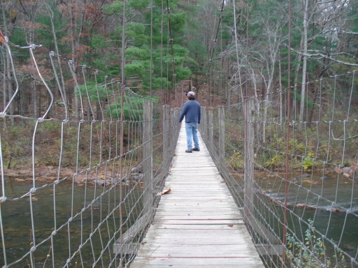
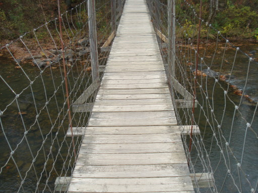
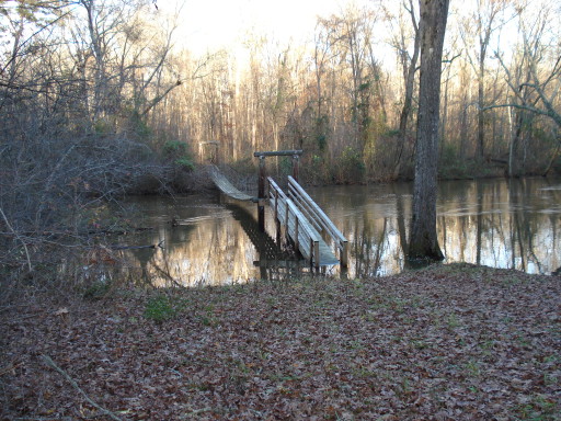
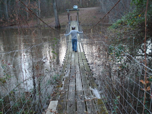
One point of interest was this swinging bridge over the Maury River. We didn't find the cache that we were looking for at the other end of the bridge, but crossing the bridge provided just a tiny bit of practice for the much higher, longer, and (for lack of a better term) spacier bridge that I would cross two weeks later while climbing the via ferrata at Nelson Rocks Preserve.
 |
 |
 |
 |
 (looking upriver from the bridge) |
 (looking downriver from the bridge) |

One cache was located on a road known locally as "the straight spur," to differentiate it from an older road known as "the crooked spur," which we also drove over (and yes, the crooked spur was very crooked). Part of the mountainside had obviously been blasted away so that a road could be run through, and I was fascinated by the geology of the vertical slate sheets that were exposed.

The hunt for another cache took us over "the crooked spur" to this modest nature trail behind a country school. The nature trail itself was not extensive or special enough that I would recommend a trip out of anyone's way to visit it--it was on the scale of the Ristich Trail in North Yarmouth--but I was impressed by the planning and building that the small (and not evidently prosperous) community of Millboro had put into creating the trail and an outdoor classroom.
 |
 |
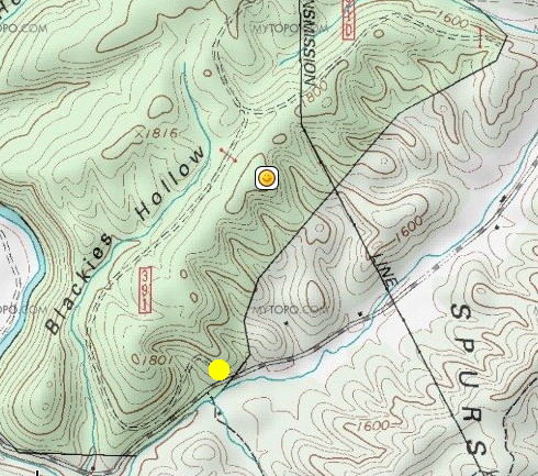
To find another geocache, we parked at the bottom of a National Forest fire road and hiked up to the top of a mountain ridge.
On the map image below, the smiley face marks the location of the cache, and the yellow dot marks our parking location. For the hike up, we took the fire road that winds around the southwest end of the mountain and then along the north side of the ridge; getting to the geocache required only a short bushwhack for the last hundred yards or so. For the return hike, we took a trail that ran along the length of the ridgetop, then bushwhacked across one of those steep gulleys that you can see carved into the southeast side of the mountain. In retrospect, it probably would have been smarter to find the fire road again and walk the "long" route back to the car, but we did have an adventure and found out what it was like to make our way across very steep ground. (Yes, we did some of it sliding on our butts.) Map credit goes to Google Maps, MyTopo, and Geocaching.com.
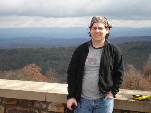
The view from the top of the ridge near the geocache was difficult to capture. You'll have to trust me that in real life, it was impressive.

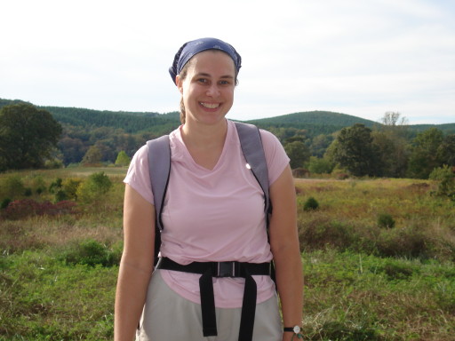
I chose this location to model the $2 "vinylized" orange vest that I, being a bit of a Nervous Nelly about hunting season, had picked up at a hardware store in the middle of nowhere on the drive out from Charlottesville.

(Notice, also, that I am in short sleeves on top of a mountain ridge in the mid-to-late afternoon on Halloween. We had a warm autumn.)
We visited a handful of other caches on the trip, but the only other really photogenic cache location was at a scenic overlook on the road.
 |
 |

The first cache we found was in the vicinity of this historical marker.
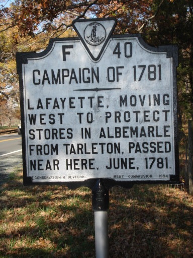
Bit of a reach for historical significance, don't you think? Somebody, on his way to do something (but not doing it yet), passed near here?
Not far from the historical marker, we found this roadside cache (pictured below) next to a dirt road between horse farms. I thought the location was interesting because roadside caches tend to be "micros" (small caches, ranging from the size of a fat bullet to a three-ounce plastic container) hidden on the backs of guardrails and road signs. This was a very large container set at the base of a tree and lightly camouflaged by the surrounding vegetation.

Lake Anna will never replace Panther Pond in my affections, but it looked nice enough. I would be interested in coming back to this park during the warmer months to take a swim and maybe try canoeing or kayaking on the lake.
 |
 |
The view of the water on the left, above, was taken from a spot near the geocache pictured below. The description promised a "unique container," and that is what we found, nestled in a small tree-hollow:
Bear Creek Lake State Park struck me as small and rustic compared to James River SP or Lake Anna SP; the trail system and facilities just didn't seem to be as up-to-date or extensive. Still, we had a nice walk on some of the park trails, and I wonder whether the swimming beach at this park might be less heavily trafficked than the one at Lake Anna.
BCLSP is adjacent to a ragged patchwork of state forest land known as the Cumberland State Forest. There's a broad multi-use trail that winds through the park and the state forest which I'd really like to go back to with a rented or borrowed mountain bike.
There are, I think, only two active geocaches within the park, although at the ranger station-cum-camp store, we did receive a leaflet giving the coordinates for various points of historical interest within the park, so we can see that they are making an effort to appeal to GPS geeks. There are several more geocaches in the state forest around the park, and we spent most of the day chasing those. We didn't get them all, but we had a good adventure along the way.
Near Arrowhead Lake, a small fishing pond in the forest, Daniel made his hundredth geocache find. (At least, we thought at the time that it was the hundredth. Later we discovered that there had been a small mix-up in the online record-keeping, and the Arrowhead Lake cache was actually his 101st.) I gave him a small gift to celebrate the occasion: a weatherproof pocket guide to common trees and wildflowers in Virginia.
Also near Arrowhead Lake, we found this skull--and only the skull, no other bones--in the woods. Looks strongly canine to me. I suppose it came from an ordinary domestic dog, but I've heard rumors of coyotes in Virginia.

My two favorite caches that we found on this day were a pair called "Swinging Bridge North" and "Swinging Bridge South." They were, as the names suggest, planted near suspension bridges that were constructed over rivers in the state forest to give access to hunters and hikers. Having been largely desensitized to the acrophobia of swinging bridges by my trip across the bridge at Nelson Rocks, I actually quite enjoyed crossing these bridges!
Here's the south swinging bridge.
 |
 |
 |
 |
The north swinging bridge presented us with a bit more of a challenge. Can you spot the problem in the picture below?
Look closer . . .

Hrm. It would seem that the builders of the bridge did not anticipate the river rising to this level!
There was no way around this bridge; we had to cross if we wanted to get the cache. We wanted to get the cache. So Dan did the first leap-and-splash, and I followed more or less in his soggy footsteps.
We didn't get too wet. Just a few splashes on the pant legs.
Near another cache location, I admired this non-swinging bridge, the pilings for which looked like they might have been built sixty or seventy years ago.
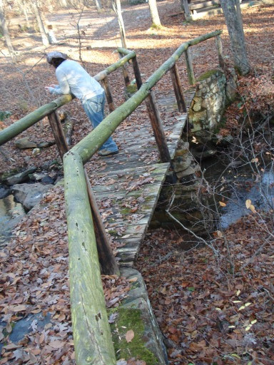
I'm finding that geocaching is a good way to discover interesting old bridges and cemeteries!
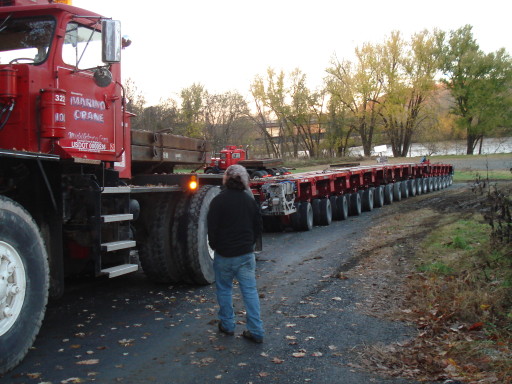
Here's a less-historical curiosity that we ran across after leaving the state forest area and heading for a couple of caches near the James River. This trailer was apparently used to bring in a large construction crane to a nearby site. I counted the tires on the trailer alone (nevermind the truck) and if I remember right, there were 18 rows of 8 tires = 144 tires on one trailer.
On this weekend, I was not feeling a hundred percent. I felt like I was coming down with something, and I was right--I would figure out later that it was the start of my bout with mono. At the time, I didn't know exactly what was going on with me, but I didn't feel up for anything strenuous, so I requested that we do some "urban caching" so that we could travel from cache to cache by car or over short distances by foot. We decided to stay in Charlottesville and nab some of the caches that we hadn't yet gotten in town. We still haven't completely cached the area out, but we did find 16 caches in a relatively short day, which surprised us.
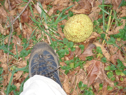
Perhaps because of the lethargy that was starting to creep up on me, or perhaps because "urban caching" just isn't as scenic as the state parks, I did not take many pictures this day. The only pictures I took, in fact, were of this Osage orange tree and its fruits scattered on the ground in Darden Towe Park. It looked like a minefield of Osage oranges.

This picture showing scale relative to my hiking boot is for any northerners who have never seen an Osage orange. It is the size of a softball.
For Thanksgiving, we drove up to New Bedford, Massachusetts to share the holiday with some of Daniel's relatives. Naturally, we cached along the way. We added serveral new states to our list of states we've geocached in, although we ended up having to give New York a miss due to travel pressures. Next time!
We found some interesting caches on the trip up the east coast. In Maryland we found a cache that was nothing special in itself--the traditional big plastic box stashed in the woods--but it was located near an old covered bridge that was undergoing a complete rebuild and restoration. When we were there, the bridge was down to its bare skeleton. (I didn't get any pictures because it was drizzling, which isn't good for the digicam, and we were ready to move on.) Also in Maryland we found a cache in a "container" that astonished us. The coordinates pointed us to the area of a large metal electrical box (like this) on the grounds of an office complex. We scoured the box and its surroundings but couldn't turn up the kind of container we were accustomed to finding. Finally Daniel discovered the cache: what had appeared, on casual inspection, to be a small warning sticker ("Danger, high voltage" or something like that) on the side of the box turned out actually to be a flat magnet with a shallow hollow in the back; folded up in the hollow was a scrap of paper for the cache log. We thought this was really surprising and unique, but having seen this kind of "hide" once, we were less astonished when we saw a similar one attached to a stop sign in Massachusetts a few days later.
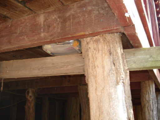
In Delaware, the coordinates for one cache led us to this odd concrete foundation or other structure, abandoned in the woods between an office park and a stream. We couldn't guess the use of it and I didn't get a wide-angle photo showing the whole thing. Anyway, at about shin height the concrete structure had a couple of these holes in it:
. . . and sticking out of one of the holes was this modified piece of tree branch, which reminded me of the cache called "Rocket" in the Harrisonburg park:

(The log sheet for the cache was a rolled-up bit of paper inside that plastic tube that looks like a magic marker.)
In Massachusetts, we stayed at the Fairhaven Hampton Inn, which was located in a pretty built-up area, surrounded by auto dealerships, chain restaunts, and shopping centers. It was a little surprising (and oddly scenic, in a way) to see this isolated remnant of a bygone era for local commerce across the parking lot from our hotel.

On our first morning in Massachusetts, we started the day by looking online for nearby geocaches (of course). The nearest cache that we could locate was rated a five out of five for level of difficulty, which was far beyond what we had attempted thus far. Our average geocaching find rates a 1.5 for difficulty. There's a separate rating scale for "terrain," so "difficulty" usually refers to the mental or technical aspect of figuring out a cache's location, while "terrain" covers the physical difficulty of getting at it. Caches with a 5 rating on the terrain scale typically require a specialized or extraordinary effort such as rock climbing or scuba diving! We debated whether we should even attempt a "five," but decided to go for it.
Once we got within a hundred yards or so of the cache, we discovered why it was also rated a three out of five for terrain: it was situated in the middle of a vast tangle of vines and briars. I took the photo below from a "clearing" in the thicket where the growth of some trees had kept some ground shaded and mostly clear of the sun-loving vines. Much of what we were walking through, though, consisted of the kind of continuous snarl of vines that you can see beyond the clear ground, in the background.

Once we got to the point where the GPS unit said we should be within a few feet of the cache, we hunted and hunted and hunted through the vine-draped trees. There's an element of error in the GPS readings--accuracy to within 19 feet is considered pretty good--and the error in our GPS could be compounded with an error in the cache hider's GPS. We have found caches as far as 40 or 50 feet off the mark of where the GPS indicated they should be, although in most cases the GPS puts us within 10 feet or so. Indeed, a geocacher who had found this cache earlier reported that he found it about 30 feet from the published coordinates, and he reported the reading he'd taken with his GPS at the cache location. So, we put the second set of coordinates into Daniel's GPS and searched there. After coming up empty-handed, we were starting to think we might be defeated by the hide, when I glanced back towards our original search area and suddenly spotted the cache!
We'd been looking mainly on the ground, under the vegetation, and in the kind of low hollow or notch in the trees where geocachers generally like to make their hides. But when I spotted the cache I discovered that it was a small camouflage-covered plastic box in plain sight, eight or ten feet up in the air, dangling from a tree limb.
The intrepid Daniel climbed the tree to get the cache. Hooray! Success!

Other southeastern Massachusetts caches took us to a variety of interesting parks and preserves around the area. We had a great time exploring. The weather was not super-nice, and on one day, it was downright adverse, with a sharp, cold wind blowing in off the ocean. We like hiking and we appreciate nature and historical sites, but I think we would not have been so motivated to go out on outdoor adventures if we hadn't had the "extra" pull of geocaches drawing us out of the cozy hotel room.
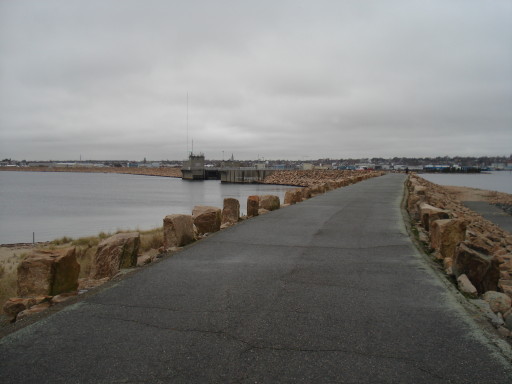
One cache took us to Fort Phoenix and the New Bedford harbor hurricane barrier.

|

|
|

|
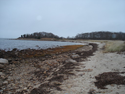
Another couple of caches drew us to West Island State Reservation (warning: that link takes you to an information-packed but also kind of junked-up web page with lots of geegaws and doodads to load). One cache was called "Backwards.. Z", the reason for which we discovered when we saw the sign at the main trailhead:

After hiking through the woods, we found ourselves on a rare and beautiful undeveloped stretch of ocean frontage, which included this salt marsh.

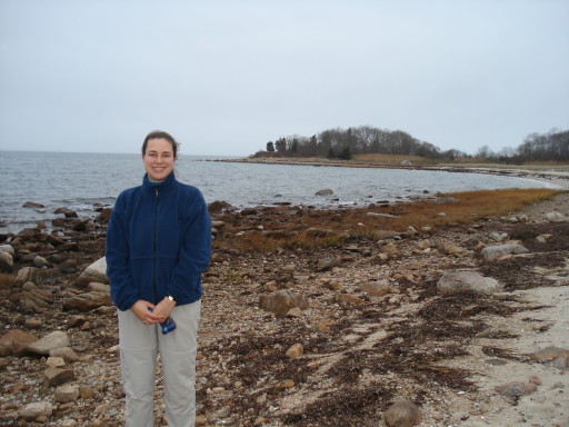
One of the caches was a "multi" which required us to walk out along this beach and back. It was a lovely walk despite the overcast weather. Must be absolutely beautiful on a sunny summer day.


Near the end of the point, we were looking for a small cache that would contain the coordinates for the final stage of the "multi-cache," a larger container hidden back in the woods on the main part of the island. The intermediate coordinates pointed us right to this tree with a broken buoy hanging in it; I was sure the buoy was going to contain (or have written on it) the clue to the final cache location! In fact, I was mistaken; the clue we were seeking was in a much more ordinary small caching container hanging nearby.
Back at the harbor, there was reportedly a cache hidden on this small island that lay just behind the hurricane barrier. For some reason, this island cache fascinated me, and I really, really wanted to go get it.

At low tide, however, the water was still eight or twelve inches deep, over a sandy bottom, between the hurricane barrier and the island.

We discussed a variety of schemes for wading out without getting wet (trash bag waders? cheap wellies?) or for drying off bare, wet feet before the chill would be unbearable. In the end, though, we decided that we would have to come back for the island cache some other time, in warmer weather or with better equipment.
We had a more successful adventure at the Gidley nature preserve. Once again, we went into the area seeking a geocache but not otherwise expecting to find anything more interesting than a path through the woods. We were delighted to discover this nineteenth-century (or built even earlier?) stone bridge over a stream.

Later, we visited Fort Taber, which is situated on a peninsula jutting out past the harbor.
It was windy . . .

. . . and quite cold, so we did not linger, but we got the cache we were looking for.
Later that day, we decided to head inland. The Acushnet Cedar Swamp State Reservation proved to be an excellent place to take shelter from the cold onshore wind. I don't seem to have any photos from the hike there, but we enjoyed the trail, even though it had many wet spots to work around. Somebody has created a series of caches in the reservation all with an Alice in Wonderland theme. One, called "Looking Glass," was hidden near a glass-smooth little pond. Another, called "Giant Mushroom Hookah," required just a little more imagination; it was hidden near a large glacial erratic in the woods. The boulder was jutting out of the ground at what appeared to be an improbable angle; it looked as though it should crash to the ground. It didn't quite look like a mushroom, really, but it did look like an appropriately surreal perch for a hookah-smoking caterpillar.
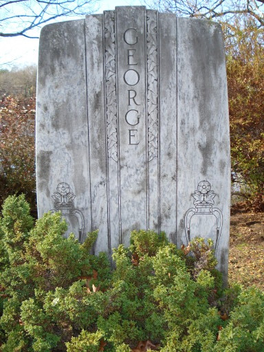
On the drive back to Virginia, we picked up a few more caches, but not many, since we were doing the whole drive in one day. (We'd broken it up over two days on the way up.) I am glad that we stopped at this high-rent cemetery located just off the interstate in Mystic, Connecticut.
 |
 |
I could have spent all day taking pictures of the funerary art.

We found a cache that had been tucked into a hollow tree on the edge of the cemetery, overlooking the Mystic River. I enjoyed the view. This was one of my favorite kinds of caches: the kind that take you someplace you would not have otherwise gone, but once you get there, you discover something interesting.